Le nostre spedizioni verranno sospese per la pausa natalizia dal 19 dicembre al 6 gennaio.
Gli ordini ricevuti in questo periodo verranno fatturati e spediti dal 7 gennaio.

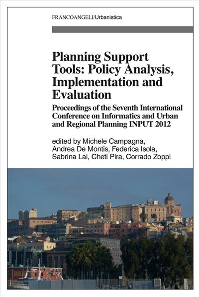
Planning Support Tools: Policy Analysis, Implementation and Evaluation.

A cura di: Michele Campagna, Andrea De Montis, Federica Isola, Sabrina Lai, Cheti Pira, Corrado Zoppi

Planning Support Tools: Policy Analysis, Implementation and Evaluation.

Proceedings of the Seventh International Conference on Informatics and Urban and Regional Planning INPUT2012

The general theme of Seventh International Conference on Informatics and Urban and Regional Planning (INPUT 2012) was "Planning support tools: policy analysis, implementation and evaluation". New technologies, the main focus of the conference, play a prominent role in the innovation of planning theory and practice, as they affect every phase of the process: knowledge building, preliminary studies, design, decision, implementation, and monitoring.

Pagine: 2198

ISBN: 9788856875973

Edizione:1a edizione 2012

Codice editore: 1862.161

Possibilità di stampa: No

Possibilità di copia: No

Possibilità di annotazione:

Formato: PDF con DRM per Digital Editions

Informazioni sugli e-book

From 10 to 12 May 2012 the University of Cagliari hosted the Seventh International Conference on Informatics and Urban and Regional Planning (INPUT 2012), organized by the Department of Civil and Environmental Engineering and Architecture (Dipartimento di Ingegneria Civile, Ambientale e Architettura) of the University of Cagliari and by the Department of Agriculture (Dipartimento di Agraria) of the University of Sassari.
The general theme of INPUT 2012 was "Planning support tools: policy analysis, implementation and evaluation": after two decades characterized by the blooming of methods, technologies, and applications, researchers are now facing the complex issue of selecting, adapting, and integrating appropriate tools for specific stages and tasks in planning. New technologies, the main focus of the conference, play a prominent role in the innovation of planning theory and practice, as they affect every phase of the process: knowledge building, preliminary studies, design, decision, implementation, and monitoring.

Michele Campagna , Res. Doct. in Spatial Planning, is Adjunct Professor of spatial planning at the University of Cagliari. His research concerns the use of Spatial Information Technology in planning.
Andrea De Montis , Res. Doct. in Urban Planning, is Associate Professor at the University of Sassari. His research concerns agricultural systems, complex systems analysis, and rural landscape analysis and planning.
Federica Isola , Res. Doct. in Environmental Sciences and Engineering, holds a research grant from the Regional Administration of Sardinia at the University of Cagliari concerning environmental assessment and planning.
Sabrina Lai , Res. Doct. in Spatial Planning and MSc in International Planning and Development, is Research Fellow at the University of Cagliari. Her research concerns the use of spatial information in planning.
Cheti Pira , Environmental engineer, Res. Doct. in Spatial Planning, holds a research grant from the Regional Administration of Sardinia at the University of Cagliari concerning environmental assessment and planning.
Corrado Zoppi , Ph. D. in Economics and Res. Doct. in Regional Planning, is Associate Professor at the University of Cagliari. His research work concerns urban, regional and environmental planning and policy.


Editorial Note
Planning Support System: open issues for research, education and the planning practice by Michele Campagna
Human settlements in urban-rural settings: key issues in reference to the framework of "Horizon 2020" by Andrea De Montis
The role of regional governance in planning processes. Reflections about the INPUT 2012 Conference by Federica Isola
Spatial visualization in planning-related research and the INPUT 2012 Conference by Sabrina Lai
Key elements in the SEA process by Cheti Pira
Planning theory and practice and the INPUT 2012 Conference by Corrado Zoppi
Challenges of development and underdevelopment in a globalizing world by Alison Brown
New technologies and planning. INPUT 2012: an arrival and a new start by Arnaldo Cecchini
Computing the image of the city by Bin Jiang
Importance of spatial relationships for geographic ontologies by Robert Laurini
Housing the poor in Asia's globalized cities by Yap Kioe Sheng
Section 1. Accessibility and planning
Accessibility, rurality and remoteness: an investigation on the Island of Sardinia, Italy by Andrea De Montis, Simone Caschili and Daniele Trogu
Developing a CBA methodology for the Scenario-based land-use impact assessment of proposed rail investments in the Leipzig Region by Eda Ustaoglu, Brendan Williams and Laura Petrov
Application of the interaction potential model to studies of centrality, accessibility, and impedances of the territory: case study of Nova Lima, Minas Gerais, Brazil by Sheyla Aguilar de Santana, Ana Clara Mourão Moura, Danilo Marques and Fernanda Borges
National borders and transport corridors in Europe: evidence of linkages in the Dublin-Belfast corridor by Laura Petrov, Brendan Williams, Harutyun Shahumyan and Sheila Convery
Sustainable structure for the quality management scheme to support improvement of accessibility of public transport and public space by Miroslava Mikušová
Section 2. Assessment of public programs
Evaluating post-accident nuclear risk by coupling GIS and rough sets theory by Salem Chakhar, Clara Pusceddu and Inès Saad
The immigrants' integration and social equity. A European best programme: Murcia by Claudia de Biase and Gabriella Rendina
Evaluation of structural funds programs of the European Union. The study case of Reggio Calabria: two different seasons, two different leadership, and two different groups of results by Francesca Nicolò
Development rights management through GIS technology: the case study of Melzo (Milan) by Franco Guzzetti, Matteo Marchetti and Alice Pasquinelli
GIS-Web approach to support spatial monitoring of housing market acquisition risk and urban property market dynamics definition by Michele Argiolas, Karol Coppola and Alberto Cruccas
Promoting local development through a new representation and interpretation of the context: the Val d'Agri case by Piergiuseppe Pontrandolfi and Antonella Cartolano
Section 3. Cultural heritage
Integrated planning of the cultural heritage. The Nora Heritage Project by Anna Maria Colavitti, Claudio Licheri and Paola Meloni
Integrating landscape design, environmental rehabilitation, cultural heritage restoration: three pioneer proposals in dismissed areas of Sardinia by Paola Pittaluga
Planning for the knowledge, conservation and optimisation of cultural heritage by Maria Vitiello and Maria Gabriella Florio
GIS-based approach to historic urban heritage: a case study by Yiannis Roukounis, Maria Giannopoulou and Konstantinos Lykostratis
Brownfield regeneration: the case study of Caserta by Bianca Petrella and Claudia de Biase
Representing the historic landscape: methodological process of creativity for the Contemporary City by Fabio Converti
Section 4. Landscape planning
Assessing the impact of the European Landscape Convention on national planning systems: a comparative approach by Andrea De Montis and Patrizia Farina
Territory diachronic maps for the Regional Landscape Plan by Donatella Cialdea and Alessandra Maccarone
Landscape fragmentation in Italy. Indices implementation to support territorial policies by Bernardino Romano and Francesco Zullo
Participation between utopia and reality. The case study of Sardinian Regional Landscape Plan by Federica Leone
Urbanisation processes in landscape protected areas in Sardinia by Manuela Porceddu and Michele Campagna
The importance of the new protected area. The "Mehedinti Plateau Geopark" in the rural development and landscape planning of Mehedinti County by Cristiana Vilcea
Section 5. Landscape, rural and urban planning
A new landscape planning approach to areas with a strongly rural matrix by Donatella Cialdea
Empirical evidence on agricultural land-use change in Sardinia (Italy) from GIS-based analysis and a Tobit model (part one) by Sabrina Lai and Corrado Zoppi
Empirical evidence on agricultural land-use change in Sardinia (Italy) from GIS-based analysis and a Tobit model (part two, continued from part one) by Sabrina Lai and Corrado Zoppi
Visibility analysis for identifying detractors in rural areas by Donatella Cialdea and Antonio Sollazzo
Biodiversity analysis within the rural-urban fringe of Craiova, a stage in the assessment of eco-compatible solutions for urban development by Sorin Avram, Alina Vladut, Gheorghe Curcan and Ioan Marinescu
Spatial Strategies in land use planning and housing location in The Netherlands by Roberta Floris
Section 6. Planning support systems
Creativity and planning process in architecture: a cognitive approach by Rossella Stufano, Dino Borri and Giovanni Rabino
The Geoprospective approach by Christine Voiron-Canicio
Geoprocessing, Multi-criteria Analysis, conflict of interest and simulation of landscape intervention: learning topics in urban planning, at UFMG - Brazil by Ana Clara Mourão Moura
A robust model for regional wastewater system planning by Joao António Zeferino, Maria da Conceição Cunha and António Pais Antunes
Geographical information systems and spatial data infrastructures can enhance planning. Case of Flanders by Greta Deruyter
Urban sprawl indicators and spatial planning: the data interoperability in INSPIRE and Plan4all by Corrado Iannucci, Luca Congedo and Michele Munafò
An ANN-based approach as support for decision-making processes regarding design of ecodistricts by Giovanni Virgilio
Spatial representations and urban planning by Gilberto Corso Pereira and Maria Célia Furtado Rocha
Planning Support prototype instrument for brownfield regeneration by Giulia Melis, Stefano Pensa and Matteo Tabasso
Gentrification and spatial analysis tools: the perspective of implementation in the City of Athens by Georgios Sidiropoulos and Margarita Stergiou
A physical land suitability evaluation model for traditional grape varieties in South Italy: a case-study for "Mantonico" grape by Francesco Barreca, Carmelo Riccardo Fichera, Luigi Laudari and Giuseppe Modica
Evaluating axial growth in Hamburg using a Cellular Automata Model and landscape metrics by Christian Daneke and Jürgen Oßenbrügge
State of the art on using Geotechnology to support neighbourhood impact studies by Gerson José de M

Collana: Urbanistica

Argomenti: Politiche urbane e territoriali

Livello: Studi, ricerche

Potrebbero interessarti anche