Towards the European harmonisation of a Soil Cadastre inventory as a tool for environmental, social, economic, legal and taxation purposes

Journal title RIVISTA DI STUDI SULLA SOSTENIBILITA'
Author/s Salvatore Raimondi, George Attard, Antonio Comparetti, Carlo Greco
Publishing Year 2020 Issue 2019/2 Suppl.
Language English Pages 23 P. 275-297 File size 114 KB
DOI 10.3280/RISS2019-002-S1018
DOI is like a bar code for intellectual property: to have more infomation click here

Below, you can see the article first page

If you want to buy this article in PDF format, you can do it, following the instructions to buy download credits
Article preview

FrancoAngeli is member of Publishers International Linking Association, Inc (PILA), a not-for-profit association which run the CrossRef service enabling links to and from online scholarly content.

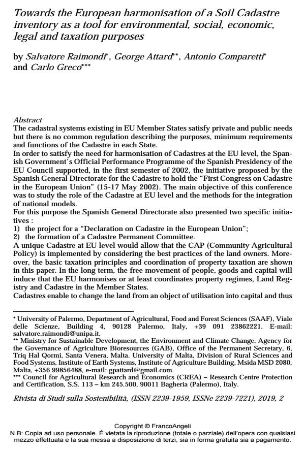
The cadastral systems existing in EU Member States satisfy private and public needs but there is no common regulation describing the purposes, minimum requirements and functions of the Cadastre in each State. In order to satisfy the need for harmonisation of Cadastres at the EU level, the Spanish Government’s Official Performance Programme of the Spanish Presidency of the EU Council supported, in the first semester of 2002, the initiative proposed by the Spanish General Directorate for the Cadastre to hold the "First Congress on Cadastre in the European Union" (15-17 May 2002). The main objective of this conference was to study the role of the Cadastre at EU level and the methods for the integration of national models. For this purpose the Spanish General Directorate also presented two specific initiatives : 1) the project for a "Declaration on Cadastre in the European Union"; 2) the formation of a Cadastre Permanent Committee. A unique Cadastre at EU level would allow that the CAP (Community Agricultural Policy) is implemented by considering the best practices of the land owners. Moreover, the basic taxation principles and coordination of property taxation are shown in this paper. In the long term, the free movement of people, goods and capital will induce that the EU harmonises or at least coordinates property regimes, Land Registry and Cadastre in the Member States. Cadastres enable to change the land from an object of utilisation into capital and thus economic growth (that is a prerequisite for investments in estate enhancement and/or environmental protection). This is an essential part of LIS (Land Information System) and GIS (Geographic Information System) systems, that provide information crucial to decision making. The new soil cadastral certificate, besides land use and capability, should also take into account the sustainability. The Ground Cadastre should be developed into a multipurpose Soil Cadastre, i.e. an inventory for environmental, social, economic, legal and taxation purposes.

Keywords: Land use, land capability, soil degradation, sustainability, landscape, territorial planning.

  1. Annoni A. (2002). Seminar 2. Coordination and regulation of the Cadastre: Initiatives within the EU. European Commission, DG Joint Research Centre, Institute for Environment and Sustainability, 1st Congress on Cadastre in the European Union, Granada (Spain). 15-17 May 2002.
  2. Ben-Eli M. (2015). Sustainability: Definition and Five Core Principles. A New Framework. A Sustainability Laboratory Publication, The Sustainability Laboratory. New York, NY 10028, USA.
  3. Bodenkamp J. (2002). Land Information Diffusion: EU Initiatives. Seminary 4. The Cadastre of the citizen. European Commission, 1st Congress on Cadastre in the European Union, Granada (Spain). 15-17 May 2002.
  4. Canton Ticino of Switzerland (2017). Ufficio del catasto e dei riordini fondiari. -- https://www4.ti.ch/dfe/de/ucr/ufficio/.
  5. Carrara M., Comparetti A., Febo P., Morello G and Orlando S. (2003). Mapping soil compaction measuring cone penetrometer resistance. 4th European Conference on Precision Agriculture (4ECPA), Berlin, Germany, 15-19 June 2003: 1-8.
  6. Carrara M., Comparetti A., Febo P. and Orlando S. (2004). Spatially variable rate herbicide application on durum wheat in Sicily. Biosystems Engineering, 87(4): 387-392. Carrara M., Castrignanò A., Comparetti A., Febo P. and Orlando S. (2005a). Multivariate geostatistics for assessing and predicting soil compaction. Proceedings of the 5th European Conference on Precision Agriculture (5ECPA), Uppsala, Sweden, 9-12 June 2005: 723-730.
  7. Carrara M., Comparetti A., Febo P. and Orlando S. (2005b). Adjustment time and offset of a system for spatially variable rate fertilisation. 5th European Conference on Precision Agriculture (5ECPA), Uppsala, Sweden, 9-12 June 2005: 1-8.
  8. Carrara M., Castrignanò A., Comparetti A., Febo P. and Orlando S. (2007). Mapping of penetrometer resistance in relation to tractor traffic using multivariate geostatistics. Geoderma, 142(3-4): 294-307.
  9. Chabal B. and Bourguignon J.-Y. (2002). From the Digitalized Cadastral Map toward a Vestorized one for the 3rd Contract on Computerization of the Cadastral Map on Ardeche, France (de la Grotte Chauvet au Cadastre numérisé). June 2002, FIG 04/2003.
  10. Comparetti A. (2011). Precision Agriculture: Past, Present and Future.
  11. Agroinzinerija ir energetika, 16. Proceedings of the International scientific conference “Agricultural Engineering and Environment – 2011”, key-note presentation, Akademija, Kaunas district, Lithuania, 22-23 September 2011, 216-230.
  12. Comparetti A., Febo P. and Orlando S. (2013). A system for the real-time geo-referenced measurement of soil parameters. Bulgarian Journal of Agricultural Science, 19(6): 1253-1257.
  13. Comparetti A. and Raimondi S. (2019). Cadastral models in EU Member States. EQA-Environmental quality/Qualité de l’Environnement/Qualità ambientale, 33: 55-78.
  14. Costantini E.A.C., Castelli F., Raimondi S. and Lorenzoni P. (2002). Assessing soil moisture regimes with traditional and new methods. Soil Science Society of America Journal, 66: 1889-1896.
  15. Durán Boo I. (2002a). The challenges of the future European Cadastre. CT - Catastro, October 2002. Director of CT-Catastro, Spain: 203-226.
  16. Durán Boo I. (2002b). Two initiatives for the approximation of the Cadastres of Member States: the “Declaration on Cadastre in the European Union” and the “Cadastre permanent committee”. Directorate General for the Cadastre. Spain. 01.I Congress on Cadastre, 9/12/02. 20:20: 207-213.
  17. Egli M., Alioth L., Mirabella A., Raimondi S., Nater M. and Verel R. (2007). Effect of climate and vegetation on soil organic carbon, humus fractions, allophanes, imogolite, Caolinite, and oxyhydroxides in volcanic soils of Etna (Sicily). Soil Science, 172(9): 673-691.
  18. Hammer M. and Champy J. (1993). Reengineering corporation: A manifesto for business revolution. New York, USA: Harper Business.
  19. Hopfer A. (2003). Cadastre as a Compact Tool for Proper Land Use – via Taxation and Physical Planning. Best Practices in Land Administration – Regional Perspectives. FIG Working Week 2003, Paris, France, April 13-17.
  20. Hornansky I. and Vališ J. (2002). Cooperation in public-private partnership. United Nations Economic Commission for Europe (UN-ECE), Committee on Human Settlements, Working Party on Land Administration (WPLA), Vienna, 12-13
  21. September. Kaufmann J. (2002). Cadastre 2014: a vision for Future Cadastral Systems. Representative of FIG, Chair Working Group 7.1 FIG. Congress on Cadastre, 9/12/02, 03 Seminar 2. Co-ordination initiatives. 20:24: 235-252.
  22. Krebs R., Egli M., Schulin R., Tobias S. (Ed.), Von Andreas Chervet B., Egli M., Fry P., Funk R., Gattinger A., Germann P., Gerwin W., Greiner L., Grob M., Hagemann N., Hansjürgens B., Helming K., Hepperle E., Keller A., Keller T., Krebs R., Leifeld J., Leuthard J., Lüscher P., Mäder P., Margreth M., Prasuhn V., Schröter-Schlaack C., Schulin R., Spielvogel S., Sturny W.G., Tobias S., Weisskopf P. and Zimmermann S. (2017). Bodenschutz für die Praxis. Haupt Verlag, Germany, pp. 122-143.
  23. Munro-Faure P. (1999). Sustainable development and Land Administration Infrastructure Use Reforms: the Role of Land Markets and Land Valuation System – Agenda For Charge. Proceedings of International Conference on Land Taxation and Cadastre Infrastructures for Sustainable Development. FIG Melbourne, Australia, pp. 134-140.
  24. Ollén J. (2002). Land information in the EU: situation and perspectives. General Director, Lantmäteriet, Sweden. 01.I Congress on Cadastre, 9/12/02. 20:20: 213-216.
  25. Puccio D. and Raimondi S. (2017). The Enviromental Problems of the Piana del Signore (Gela, Sicily) for a Correct Agronomic, Cultural and Landscape Upgrading and Enhancement of the Area. EQA-Environmental quality/Qualité de Environnement/Qualità Ambientale, 25: 19-32.
  26. Raimondi S., Calafiore G., Indorante A. and Tusa D. (2003). Proposta di un modello ecologico di stima dei danni per la siccità: esempio nell’area “San Cataldo” (Sicilia centrale - Caltanissetta). Atti del convegno annuale della SISS dal titolo “La conservazione della risorsa suolo”. Piacenza, 8-10 giugno. Bollettino SISS, 52(1-2) : 567-578.
  27. Città di Castello (Perugia): Delta Grafica. Raimondi S. (2009). Il processo di lisciviazione dei sali solubili in relazione all’andamento climatico nella piana di Gela (Sicilia). Atti del Convegno "Clima e Agricoltura: strategie di adattamento e mitigazione”. Sassari, 15-17 giugno 2009.
  28. Italian Journal of Agrometeorology, giugno, 1-2. Società Italiana di Agrometeorologia (AIAM). Bologna: Patron Editore, -- http://www.agrometeorologia.it/joomla/it/joomla-forums/98-convegno-aiam-2009.html.
  29. Raimondi S. and Cangelosi V. (2013). Gli effetti dell’incendio sulla morfologia dei suoli nell’area Vaccheria (Collesano-PA). “La sensibilità alla desertificazione del sottobacino Iudeo-Bucari (bacino del fiume Mazaro - TP)”. Dipartimento Scienze Agrarie e Forestali, Università di Palermo e Assessorato Territorio ed Ambiente della Regione Sicilia. Compostampa edizioni, Palermo, cd; 25 giugno. -- www.compostampa.it: 368-408.
  30. Raimondi S. and Interrante F. (2014). L’incremento della sostenibilità ambientale attraverso la diminuzione del rischio erosivo. “Vino e Ambiente: sostenibilità e qualità primaria nel sottobacino Iudeo-Bucari (TP)”. Compostampa edizioni, Palermo, cd; 22 settembre 2014. -- www.compostampa.it: 1-14.
  31. Raimondi S. (2017). The structure of Soil Cadastre. a model of soil inventory for environmental, social, economic and taxation purposes in a globalised market. EQA-Environmental quality/Qualité de l’Environnement/Qualità ambientale, 25: 49-63. Ratia J. (2002). Cadastres as Focuses on Environmental Protection. Director General,
  32. National Land Survey of Finland. Congress on Cadastre, 9/12/02. 05. Seminary 4. 20:33: 279-283.
  33. Scacco A., Verzera A., Lanza C. M., Sparacio A., Genna G., Raimondi S., Tripodi G. and Dima G. (2010). Influence of Soil salinity on sensory characteristics and volatile aroma compounds of Nero d’Avola wine. American Society for Enology and Viticulture, 61(4): 498-505.
  34. Tuladhar A.M. (2003). Reengineering Cadastre and Land Registration Systems and Business Opportunities. The Netherlands. TS15.1 Standards and Interoperability, FIG Working Week 2003, Paris, France, April 13-17, 2003: 1-11.
  35. United Nations Economic Commission for Europe (UN-ECE)/Working Party on Land Administration (WPLA) (1998). Social and Economic Benefits of Good Land Administration, Geneva, pp. 1-23.
  36. United Nations Economic Commission for Europe (UN-ECE)/Working Party on Land Administration (WPLA) (2001).
  37. van Der Molen P. (2002). The use of the Cadastre among the Members States. Property rights, land registration and Cadastre in the European Union. Land Registry and Cadastre Agency, Holland. 02.Seminar 1. The use of the Cadastre. 9/12/02. 20:22: 227-230.
  38. van Der Molen P. and Österberg T. (1999). Land Tenure and Land Administration for Social and Economic development in (Western) Europe. UN/FIG International Conference on Land Tenure and cadastral Infrastructures for Sustainable Development, Melbourne, Australia, pp. 276-298.
  39. van Oosterom P., Lemmen C., Ingvarsson T., Van Der Molen P., Ploeger H., Quak W., Stoter J. and Zevenbergen J. (2006). The core cadastral domain model. Computers, Environment and Urban Systems, 30: 627-660. -- www.elsevier.com/locate/compenvurbsys
  40. Williamson I., Enemark S., Wallace J. and Rajabifard A. (2010). Land Administration for Sustainable Development. 380 New York Street, Redlands, California 92373-8100, USA: Esri Press, First edition.

  • National development strategies in terms of ensuring environmental rights and interests: Comparative approach Anatolii P. Getman, Hanna V. Anisimova, in Journal of the National Academy of Legal Sciences of Ukraine /2021 pp.250
    DOI: 10.37635/jnalsu.28(4).2021.250-261
  • XV International Scientific Conference “INTERAGROMASH 2022” Kirill Zhichkin, Lyudmila Zhichkina, Oleg Mamaev, Olga Grunina, Alexander Tarakanov, Irada Rustamova, Galina Korneva, pp.2983 (ISBN:978-3-031-21431-8)

Salvatore Raimondi, George Attard, Antonio Comparetti, Carlo Greco, Towards the European harmonisation of a Soil Cadastre inventory as a tool for environmental, social, economic, legal and taxation purposes in "RIVISTA DI STUDI SULLA SOSTENIBILITA'" 2 Suppl./2019, pp 275-297, DOI: 10.3280/RISS2019-002-S1018