All’ombra del vulcano

Titolo Rivista TERRITORIO
Autori/Curatori Valerio Cutini, Valerio Di Pinto
Anno di pubblicazione 2018 Fascicolo 2018/85
Lingua Italiano Numero pagine 14 P. 134-147 Dimensione file 1845 KB
DOI 10.3280/TR2018-085016
Il DOI è il codice a barre della proprietà intellettuale: per saperne di più clicca qui

Qui sotto puoi vedere in anteprima la prima pagina di questo articolo.

Se questo articolo ti interessa, lo puoi acquistare (e scaricare in formato pdf) seguendo le facili indicazioni per acquistare il download credit. Acquista Download Credits per scaricare questo Articolo in formato PDF
Anteprima articolo

FrancoAngeli è membro della Publishers International Linking Association, Inc (PILA)associazione indipendente e non profit per facilitare (attraverso i servizi tecnologici implementati da CrossRef.org) l’accesso degli studiosi ai contenuti digitali nelle pubblicazioni professionali e scientifiche

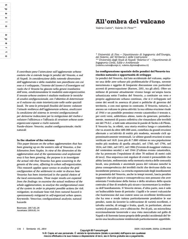
Il contributo pone l’attenzione sull’agglomerato urbano costiero che si estende lungo le pendici del Vesuvio, a sud di Napoli. In considerazione della notevole dimensione dell’agglomerato e della modalità non pianificata con cui esso si è sviluppato, l’intento del lavoro è d’investigare sul ruolo che il Vesuvio ha giocato nella genesi insediativa dell’area, condizionandone le modalità auto-organizzative. Il tessuto urbano costiero è studiato mediante le tecniche di analisi configurazionale, con l’obiettivo di determinare se il vulcano sia stato interiorizzato nelle scelte spaziali locali. Tre sono le principali finalità del lavoro: valutare l’attuale resilienza dell’agglomerato urbano, analizzare la condizione del sistema in termini configurazionali per derivarne indicazioni per la mitigazione del rischio e valutare l’efficienza e l’efficacia di strutture urbane autoorganizzate esposte a rischi naturali.;

Keywords:Vesuvio; analisi configurazionale; rischi naturali

  1. Abshirini E., Koch D., 2017, «Resilience, Space Syntax and Spatial Interfaces: the case of River cities». ITU J Faculty Arch., 14: 25-41.
  2. Al-Sayed K., Turner A., Hillier B., Iida S., Penn A., 2014 (4th Edition), Space Syntax Methodology. London: Bartlett School of Architecture, ucl.
  3. Barbieri F., Zuccaro G., 2004, Somma Vesuvio MESIMEX – 2004/393427: Final Technical Implementation Report. Roma: ec. -- http://ec.europa.eu/echo/files/policies/prevention_preparedness/mesimex.pdf (accessed on 2018.02.13).
  4. Barnes K., 2011, «Europe’s ticking time bomb». Nature, 473: 140-141. DOI: 10.1063/PT.5.025301
  5. Carpenter A., 2013, «Disaster resilience and the social fabric of space». In: Kim Y.O., Park H.T., Seo K.W. (eds.), Proceedings of the 9th International Space Syntax Symposium. Seoul: Sejong University Press.
  6. Castillo M.M., 2013, «Urban Patterns and Disaster Risk». In: Kim Y.O., Park H.T., Seo K.W. (eds.), Proceedings of the 9th International Space Syntax Symposium. Seoul: Sejong University Press.
  7. Cutini V., Di Pinto V., 2015, «On the slopes of Vesuvius: Configuration as a thread between hazard and opportunity». In: Karimi K., Vaughan L., Sailer K., Palaiologou G., Bolton T. (eds.), Proceedings of the 10th International Space Syntax Symposium. London: Space Syntax Laboratory, The Bartlett School of Architecture, University College London.
  8. Cutter S.L., Boruff B.J., Shirley W.L., 2003, «Social Vulnerability to Environmental Hazards». Social Science Quarterly, 84: 242-261. DOI: 10.1111/1540-6237.840200
  9. Esposito A., 2016, «Assessing impacts of flood events in urban areas to understand the resilience of the urban system». Napoli: Università degli Studi di Napoli ‘Federico II’ (tesi di dottorato). -- www.fedoa.unina.it/id/eprint/11099 (ultimo accesso 2018.02.13).
  10. Conroy Dalton N.S., 2010, «Synergy, Intelligibility and Revelation in neighbourhood places». London: University College of London (doctoral thesis). -- http://discovery.ucl.ac.uk/1334117/1/1334117.pdf (accessed on 2018.02.13).
  11. Cutini V., 1999, «Configuration and Movement. A Case Study on the Relation between Movement and the Configuration of the Urban Grid».
  12. In: Rizzi P. (ed.), CUPUM ‘99 Computers in Urban Planning and Urban Management. On the edge of the millenium. Proceedings of the 6th International Conference, Venice 1999. Milano: FrancoAngeli.
  13. Cutini V., 2013, «The city when it trembles. Earthquake destructions, post-earthquake reconstruction and grid configuration». In: Kim Y.O., Park H.T., Seo K.W. (eds.), Proceedings of the 9th International Space Syntax Symposium. Seoul: Sejong University Press.
  14. Cutini V., 2016, «Motorways in Metropolitan Areas: The Northwestern Growth of Florence and the Urban Use of Motorway A1». International Journal of Geo-Information, 77: 1-18.
  15. Esposito A., Di Pinto V., 2014, «Urban resilience and risk assessment. How urban layout affects flood risk in the city». Guimarães, 30 giugno-3 luglio (contributo presentato a: ICCSA 2014 - The 14th International Conference on Computational Science and its Applications) DOI: 10.1109/ICCSA.2014.4
  16. Esposito A., Di Pinto V., 2015, «The calm after the storm. The configurational approach to manage flood risk in river-cities». In: Karimi K., Vaughan L., Sailer K., Palaiologou G., Bolton T. (eds.), Proceedings of the 10th
  17. International Space Syntax Symposium. London: Space Syntax Laboratory, The Bartlett School of Architecture, University College London Fischler M.A., Firscheim O., 1987, Intelligence: the Eye, the Brain, and the Computer. Reading (Ma): Addison Wesley.
  18. Galderisi A., 2014, «Urban resilience: A framework for empowering cities in face of heterogeneous risk factors». ITU J Faculty Arch., 11: 36-58.
  19. Gil J., Steinbach P., 2008, «From flood risk to indirect flood impact: evaluation of street network performance for effective management, response and repair». In: Proverbs D., Brebbia C.A., Penning-Roswell
  20. E. (eds.), Proceedings of FRIAR 2008. Southampton: Wessex Institute of Technology Press.
  21. Hillier B., 1999, «The common language of space: a way of looking at the social, economic and environmental functioning of cities on a common basis». Journal of Environmental Sciences, 11: 344-349.
  22. Hillier B., 1996, Space is the machine. A configurational theory of architecture. Cambridge: Cambridge University Press.
  23. Hillier B., Hanson J., 1984, The Social Logic of Space. Cambridge: Cambridge University Press.
  24. Hillier B., Hanson J., Graham H., 1987, «Ideas are in Things: An Application of the Space Syntax Method to Discovering House Genotypes».
  25. Environment and Planning B: Urban Analytics and City Science, 14: 363-385.
  26. Hillier B., Iida S., 2005, «Network effects and psychological effects: A theory of urban movement». In: van Nes A. (ed.), Proceedings of the 5th International Symposium on Space Syntax. Amsterdam: Techne Press.
  27. Hillier B., Penn A., Hanson J., Grajewski T., Wu J., 1993, «Natural Movement: or, Configuration and Attraction in Urban Pedestrian Movement».
  28. Environment and Planning B: Urban Analytics and City Science, 20: 29-66.
  29. Hillier B., Turner A., Yang T., Park H.T., 2010, «Metric and topo-geometric properties of urban street networks: some convergences, divergences and new results». The Journal of Space Syntax, 1: 258 – 279.
  30. Jha A., Miner T., Stanton-Geddes Z., 2013, Building Urban Resilience: Principles, Tools and Practice. Washington D.C.: World Bank Publications.
  31. Koch D., Carranza P.M., 2013, «Syntactic resilience». In: Kim Y.O., Park H.T., Seo K.W. (eds.), Proceedings of the 9th International Space Syntax Symposium. Seoul: Sejong University Press.
  32. Marcus L., Colding J., 2014, «Toward an integrated theory of spatial morphology and resilient urban systems». Ecology and Society, 19: 55.
  33. Mohareb N.I., 2011, «Emergency evacuation model: accessibility as a starting point». In: Proceedings of the ICE (Institution of Civil Engineers) – Urban Design and Planning, 164: 215–224.
  34. Mohareb N.I, 2009, «Emergency Evacuation Model for Urban Places: Accessibility Model Framework». Parigi, 24-26 giugno (contributo presentato a: International Conference on Applied Social Modeling and Simulation - ICASMS).
  35. Papathoma-Köhle M., Gems B., Sturm M., Fuchs S., 2017, «Matrices, curves and indicators: A review of approaches to assess physical vulnerability to debris flows». Earth-Science Reviews, 171: 272-288.
  36. Paton D., 2003, «Disaster preparedness: a social-cognitive perspective». Disaster Prevention and Management: An International Journal, 12: 210-216. DOI: 10.1108/09653560310480686
  37. Paton D., Johnston D., 2006, Disaster Resilience: an Integrated Approach. Springfield (Il): Charles C. Thomas.
  38. Paul A., 2013, «A syntactic approach to identifying land-use influence on vehicular movement: the case of Lubbock». International Journal of Urban Sciences, 17: 71-84. DOI: 10.1080/12265934.2013.766500
  39. Pelling M., 2003, The Vulnerability of Cities: Natural Disasters and Social Resilience. New York: Earthscan.
  40. Penchev G., 2016, «Using Space Syntax For Estimation Of Potential Disaster Indirect Economic Losses». Comparative Economic Research, 19: 125-141.
  41. Penn A., Hillier B., Banister D., Xu j., 1998, «Configurational modelling of urban movement networks». Environment and Planning B: Planning & Design, 25: 59-84.
  42. Porta S., Crucitti P., Latora V., 2006a, «The network analysis of urban streets: a primal approach». Environment and Planning B: Urban Analytics and City Science, 33: 705-725.
  43. Porta S., Crucitti P., Latora V., 2006b, «The network analysis of urban streets: a dual approach». Physica A: Statistical Mechanics and its Applications, 369: 853-866.
  44. Presidenza del Consiglio dei Ministri – Dipartimento della Protezione Civile, 1995, Piano Nazionale d’emergenza dell’Area Vesuviana.
  45. Presidenza del Consiglio dei Ministri – Dipartimento della Protezione Civile, 2006, Piano di allontanamento definitivo - Rapporto finale.
  46. Ratti C., 2004, «Urban texture and space syntax: some inconsistencies». Environment and Planning B: Planning & Design, 31: 487-499.
  47. Salingaros N., 2005, Principles of Urban Structure. Amsterdam: Techne Press.
  48. Sari F., Kubat A.S., 2012, «Syntactic properties of evacuation and access routes in earthquake vulnerable settlements». In: Greene M., Reyes J., Castro A. (eds.), Proceedings of the 8th International Space Syntax Symposium. Santiago de Chile: PUC.
  49. Turner A., 2005, «An algorithmic definition of the axial map». Environment and Planning B: Planning and Design, 32: 425-444.
  50. Turner A., 2004, Depthmap 4: a researcher’s handbook. London: Bartlett School of Graduate Studies, University College London.
  51. Turner A., 2001, «Angular Analysis». In: Peponis J., Wineman J., Bafna S. (eds.), Proceedings of the 3rd International Space Syntax Symposium. Atlanta: Georgia Institute of Technology.
  52. Varoudis T., 2012, «DepthmapX Multi-Platform Spatial Network Analysis Software, Version 0.30 OpenSource». -- http://archtech.gr/varoudis/depthmapX (accessed on 2018.02.13).

Valerio Cutini, Valerio Di Pinto, All’ombra del vulcano in "TERRITORIO" 85/2018, pp 134-147, DOI: 10.3280/TR2018-085016