The geography of Italian museums: assessing the potential of Volunteered Geographic Information (vgi) for territorial analysis

Journal title TERRITORIO
Author/s Francesco Balducci
Publishing Year 2020 Issue 2019/90
Language Italian Pages 13 P. 141-153 File size 497 KB
DOI 10.3280/TR2019-090016
DOI is like a bar code for intellectual property: to have more infomation click here

Below, you can see the article first page

If you want to buy this article in PDF format, you can do it, following the instructions to buy download credits
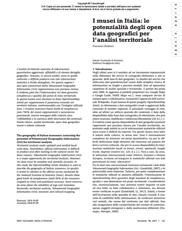
Article preview

FrancoAngeli is member of Publishers International Linking Association, Inc (PILA), a not-for-profit association which run the CrossRef service enabling links to and from online scholarly content.

Territorial analysis needs updated and verified localscale data. Nonetheless, official information is difficult to produce and often lacking in the cultural sector. For those reasons, Volunteered Geographic Information (vgi) is a major opportunity for territorial analysts. However, vgi data must be complete and spatially accurate. In this study the OpenStreetMap (osm) database is used to describe the geography of Italian museums; its quality is tested in relation to the official survey conducted by the National Institute of Statistics (Istat). Results show good levels of completeness (with 86% of the museums mapped on osm) and positional accuracy. Some concerns do arise about the reliability of tags and metadata.

Keywords: Territorial analysis, Volunteered Geographic Information (vgi); museum and cultural mapping.

  1. Antoniou V., Skopeliti A., 2015, «Measures and indicators of vgi quality: An overview». ISPRS annals of the photogrammetry, remote sensing and spatial information sciences, 2, 345.
  2. Barrington-Leigh C., Millard-Ball A., 2017, «The world’s user-generated road map is more than 80% complete». PLoS ONE, 12,8: 1-20.
  3. Barro R.J., 1999, «Determinants of Democracy», Journal of Political Economy 107, 6, S158- S183 DOI: 10.1086/250107
  4. Barron C., Neis P., Zipf A., 2014, A Comprehensive Framework for Intrinsic OpenStreetMap Quality Analysis, Transactions in gis, 2014, 18, 6: 877-895.
  5. Brando B., Bucher C., 2010, Quality in User-Generated Spatial Content: A Matter of Specifications. In Proceedings of the 13th Association of Geographic Information Laboratories for Europe International Conference on Geographic Information Science. -- http://agile.gis.geo.tu-dresden.de/Conference_Paper/CDs/AGILE2010/ShortPapers_PDF/105_DOC.pdf (accessed on: 2019.07.10)
  6. Bright J., De Sabbata S., Lee S., Ganesh B., Humphreys DK, 2018, OpenStreetMap data for alcohol research: Reliability assessment and quality indicators, Health & Place, Vol. 50, 2018,
  7. Candela G., Scorcu A.E., 2004, Economia delle Arti, Bologna: Zanichelli.
  8. Cauchi-Santoro, R., 2016, «Mapping community identity: Safeguarding the memories of a city’s downtown core». City, Culture and Society, 7, 1, 43–54.
  9. Chrisman N.R., 1991, «The error component in spatial data». In: Maguire D.J., Goodchild M.F., Rhind D.W. (eds.), Geographical Information Systems: Overview Principles and Applications. London: Longman.
  10. Chua A., Servillo L., Marcheggiani E., Moere A.V., 2016, «Mapping Cilento: Using geotagged social media data to characterize tourist flows in southern Italy». Tourism Management, 57, 295-310.
  11. Craun K.J., 2014, A comparison of Volunteered Geographic Information (vgi) collected in rural areas to vgi collected in urban and suburban areas of the United States. Master Of Science Thesis, Northwest Missouri State University.
  12. Davidovic N., Mooney P., Stoimenov L., Minghini M., 2016, «Tagging in Volunteered Geographic Information: An Analysis of Tagging Practices for Cities and Urban Regions in OpenStreetMap». isprs International Journal of Geo-Information, 5, 12.
  13. Devillers R., Bédard Y., Jeansoulin R., Moulin B., 2007, «Towards spatial data quality information analysis tools for experts assessing the fitness for use of spatial data». International Journal of Geographical Information Science 21: 261-82. DOI: 10.1080/13658810600911879
  14. Duxbury N., Garrett-Petts W. F., MacLennan D., 2015, Cultural mapping as cultural inquiry: introduction to an emerging field of practice.
  15. In: Duxbury N., Garrett-Petts W. F., MacLennan D., (eds.), Cultural mapping as cultural inquiry. New York-London: Routledge, 1-42. DOI: 10.4324/9781315743066-1
  16. Elmes G., Challig H., Karigomba W., McCusker B., Weiner D., 2004, Local
  17. knowledge doesn’t grow on trees: Community-integrated geographic information systems and rural community self-definition. In: Fisher
  18. P.F. (ed.), Advances in spatial data handling. Berlin: Springer Science and Business Media, 29-40.
  19. Elwood S., 2006, «Critical issues in participatory gis: Deconstructions, reconstructions, and new research directions». Transactions in gis, 10, 5: 693-708.
  20. European Commission, 2000, Cultural Statistics in the eu: Final report of the LEG, Eurostat Working Papers: Population and social conditions, 3/2000/E/N°1, European Commission, Luxembourg.
  21. European Commission, 2012, European Statistical System Network on Culture, ESSnet-Culture Final Report
  22. Eurostat, 2011, Cultural statistics. Luxemburg: Eurostat Pocketbooks. -- http://ec.europa.eu/eurostat/documents/3930297/5967138/KS-32-10-374-EN.PDF/07591da7-d016-4065-9676-27386f900857?version=1.0 (ultimo accesso: 20 19.7.10).
  23. Eurostat, 2016, Culture statistics 2016. DOI: 10.2785/56811
  24. Freitas R., 2016, «Cultural mapping as a development tool». City, Culture and Society, 7, 1: 9-16.
  25. Flanagin A.J., Metzger M.J., 2008, «The credibility of volunteered geographic information». GeoJournal, 72, 137-148.
  26. Frey B.S., 2000, Arts and Economics. Berlin: Springer. DOI: 10.1007/978-3-662-04225-0
  27. Fukuyama F., 2002, «Social Capital and Development: The coming agenda ». SAIS Review, 12, 1: 23-37.
  28. Goodchild M.F., Hunter G.J., 1997, «A simple positional accuracy measure for linear features». International Journal of Geographical Information Science 11: 299-306. DOI: 10.1080/136588197242419
  29. Goodchild M.F., 2007, «Citizens as sensors: The world of volunteered geography». GeoJournal, 69, 4: 211-221.
  30. Goodchild M.F., Li L., 2012, «Assuring the quality of volunteered geographic information». Spatial Statistics, 1: 110-120.
  31. Goodchild M.F., Longley P.A., 2019, Geographic Information Science. In: Fischer M., Nijkamp P. (eds), Handbook of Regional Science. Berlin-Heidelberg: Springer.
  32. Goetz M., Zipf A., 2011, «Extending OpenStreetMap to Indoor Environments: Bringing Volunteered Geographic Information to the Next Level».
  33. In: Proceedings of the 28th Urban Data Management Symposium. Delft, The Netherlands, 28–30 September 2011.
  34. Girres J-F., Touya G., 2010, «Quality assessment of the French OpenStreetMap dataset». Transactions in gis 14: 435-59.
  35. Haklay M., 2010, «How good is volunteered geographical information? A comparative study of OpenStreetMap and ordnance survey datasets». Environment and Planning B: Planning and Design, 37, 4: 682-703.
  36. Haklay M., 2017, «Volunteered geographic information and citizen science ». In Kitchin R., Lauriault T., Wilson M., Understanding spatial media. London: SAGE Publications Ltd.
  37. Haworth, B., Bruce E., 2015, «A Review of Volunteered Geographic Information for Disaster Management».Geography Compass, 9: 237-250.
  38. Hochmair H.H., Zielstra D., Neis P., 2015, «Assessing the Completeness of Bicycle Trail and Lane Features in OpenStreetMap for the United States». Transactions in gis 19, 1: 63-81.
  39. Hosagrahar J., Soule J., Fusco Girard L., Potts A., 2016, Cultural Heritage, The Un Sustainable Development Goals, And The New Urban Agenda. Bdc. Bollettino Del Centro Calza Bini, 16, 1: 37-54. DOI: 10.6092/2284-4732/4113
  40. Howe J., 2006, «The Rise of Crowdsourcing». Wired Magazine. June 2006. Istat, 2016, Sistema informativo integrato su ‘I musei, le aree archeologiche e i monumenti italiani’, Istat-Mibact 2016. -- http://imuseiitaliani.beniculturali.it/sii2016/ (ultimo accesso: 2019.07.10).
  41. Jackson S., Mullen W., Agouris P., Crooks A., Croitoru A., Stefanidis A., 2013, «Assessing Completeness and Spatial Error of Features in Volunteered Geographic Information». ISPRS International Journal of Geo-Information, 2, 2: 507-530.
  42. Jaro M.A., 1989, «Advances in record linkage methodology as applied to the 1985 census of Tampa Florida». Journal of the American Statistical Association, 84, 406: 414-20. DOI: 10.1080/01621459.1989.10478785
  43. Kashian A., Rajabifard A., Chen Y., Richter K.F., 2017, «osm poi Analyzer: A Platform For Assessing Position Of POIs». Openstreetmap, Int. Arch.
  44. Photogramm. Remote Sens. Spatial Inf. Sci., XLII-2/W7: 497-504.
  45. Katz J., 1999, Brève histoire de la formation à l’entrepreneuriat dans l’enseignement supérieur aux Etats-Unis, oecd, leed Programme.
  46. Kresse W., Fadaie K., 2004, iso Standards for Geographic Information. Heidelberg: Springer.
  47. Li J., Xu L., Tang L., Wang S., Li L., 2018, «Big data in tourism research: A literature review». Tourism Management, 68: 301-323.
  48. Longley A., Duxbury N., 2016, «Introduction: Mapping cultural intangibles ». City, Culture and Society, 7, 1: 1-7.
  49. Minghini M., Brovelli M.A., Frassinelli F., 2018, «An Open Source Approach For The Intrinsic Assessment Of The Temporal Accuracy, Up-To-Dateness And Lineage Of Openstreetmap». The International Archives of the Photogrammetry, Remote Sensing and Spatial Information Sciences, XLII-4/W8, 2018 FOSS4G 2018 - Academic Track, 29-31 August 2018, Dar es Salaam, Tanzania
  50. Mocnik F.B., Zipf A., Raifer M., 2017, «The OpenStreetMap folksonomy and its evolution». Geo-Spatial Information Science, 20, 3: 219-230. DOI: 10.1080/10095020.2017.1368193
  51. Mooney P., Corcoran P., Winstanley A, 2010, «A study of data representation of natural features in OpenStreetMap». In: Proceedings of the Sixth International Conference on Geographic Information Science. Zurich, Switzerland.
  52. Mooney P., Corcoran P., 2012a, «Characteristics of heavily edited objects in OpenStreetMap». Future Internet 4: 285-305.
  53. Mooney P., Corcoran P., 2012b, The annotation process in OpenStreetMap. Transactions in gis 16: 561–79.
  54. Mooney P, Minghini M., 2017, «A Review of OpenStreetMap Data». In: Foody G., See L., Fritz S., Mooney P., Olteanu-Raimond A-M., Fonte C.C., Antoniou V. (eds.), Mapping and the Citizen Sensor. London: Ubiquity Press, 37–59.
  55. Napolitano M., Mooney P., 2012, mvp osm: A Tool to Identify Areas of High Quality Contributor Activity in OpenStreetMap. -- https://github.com/napo/mvp-osm (ultimo accesso: 2019.07.10).
  56. Neis P., Zipf A., 2012, «Analyzing the Contributor Activity of a Volunteered Geographic Information Project – The Case of OpenStreetMap».
  57. ISPRS International Journal of Geo-Information, 1, 3: 146-165.
  58. Neis P., Zielstra D., Zipf A., 2013, «Comparison of volunteered geographic information data contributions and community development for selected world regions». Future Internet 5: 282-300
  59. O’ Connor J., 1998, The Cultural Production Sector in Manchester, Research and Strategy, Manchester City Council, North West Arts Board in association with Manchester tec and Manchester Investment and Development Agency (midas), Manchester.
  60. oecd, 2005, Culture And Local Development - ISBN 92-64-00990-6 - © oecd 2005
  61. Putnam R., 1995, «Bowling alone: America’s declining social capital», Journal of Democracy, 6, 1: 65-78.
  62. Roick O., Loos L., Zipf A., 2012, «A Technical Framework for Visualizing Spatio-Temporal Quality Metrics of Volunteered Geographic Information ». In: Proceedings of the Conference Geoinformatik, Braunschweig, Germany. DOI: 10.1007/978-3-319-23374-1_5
  63. Santagata W., Signorello G., 1998, «Contingent Valuation of a Cultural Public Good and Policy Design : The Case of ‘Napoli Musei Aperti’», Working Paper, University of Torino, (Department of Economics) and University of Catania (Dipartimento di Scienze Economiche Agraria), Turin.
  64. See L., Mooney P., Foody G., Bastin L., Comber A., Estima J., Fritz S., Kerle N., Jiang B., Laakso M., Liu H., Milˇcinski G., Nikšiˇc M., Painho M., P ˝odör A., Olteanu-Raimond A., Martin Rutzinger M., 2016, «Crowdsourcing, Citizen Science or Volunteered Geographic Information? The Current State of Crowdsourced Geographic Information», isprs Int. J. Geo-Inf. 2016, 5, 55.
  65. Sehra S.S., Singh J., Rai H.S, 2017, «Assessing OpenStreetMap Data Using Intrinsic Quality Indicators: An Extension to the qgis Processing Toolbox ». Future Internet 2017, 9, 15.
  66. Sieber R., 2006, «Public participation geographic information systems: A literature review and framework». Annals of the American Association of Geography, 96, 3: 491-507.
  67. Sieber R.E., Haklay M., 2015, «The epistemology (s) of volunteered geographic information: a critique». Geo: Geography and Environment, 2,2: 122-136.
  68. Stirling A., 1999, On the Economics and Analysis of Diversity, University of Sussex.
  69. Throsby D., 2001, Economics and Culture. Cambridge: Cambridge University Press. DOI: 10.1111/1468-0335.00005
  70. Throsby D., 2010, The Economics of Cultural Policy. Cambridge: cup.
  71. Turner A., 2006, Introduction to neogeography. Sebastopol, ca: O’Reilly Media.
  72. unesco, 1986, The unesco Framework for Culture Statistics, Paper prepared for the Third Joint Meeting on Cultural Statistics, CES/AC.44/11, 13, unesco, Paris.
  73. van Exel M., Dias E., Fruijtier S., 2010, «The impact of crowdsourcing on spatial data quality indicators». In: Proceedings of the Sixth International Conference on Geographic Information Science (GIScience 2010) Workshop on the Role of Volunteered Geographic Information in Advancing Science, Zurich, Switzerland DOI: 10.1007/978-94-007-4587-2_10
  74. Van Oort, 2006, Spatial Data Quality: from description to application, PhD thesis, Wageningen University.
  75. Vecco M., 2007, L’evoluzione del concetto di patrimonio culturale. Milano: FrancoAngeli.
  76. Winkler W.E., 1990, «String Comparator Metrics and Enhanced Decision Rules in the Fellegi-Sunter Model of Record Linkage». Proceedings of the Section on Survey Research Methods. American Statistical Association: 354-359. DOI: 10.1007/0-387-69505-2_9
  77. Winkler W.E., 2006, Overview of Record Linkage and Current Research Directions. Research Report Series, rrs.
  78. Xiang Z., Gretzel U., 2010, «Role of social media in online travel information search». Tourism Management, 31, 2: 179-188.
  79. Zhang L., Pfoser D., 2019, «Using OpenStreetMap point-of-interest data to model urban change - A feasibility study». PLoS ONE, 14, 2.
  80. Zielstra D., Hochmair H., Neis P., 2013, «Assessing the effect of data imports on the completeness of OpenStreetMap: A United States case study». Transactions in gis, 17: 315-334.

Francesco Balducci, I musei in Italia: le potenzialità degli open data geografici per l’analisi territoriale in "TERRITORIO" 90/2019, pp 141-153, DOI: 10.3280/TR2019-090016