A Web-based decision support system for sustainable urban planning and management

Journal title TERRITORIO
Author/s Carolina Salvo, Alessandro Vitale
Publishing Year 2024 Issue 2023/106
Language Italian Pages 12 P. 165-176 File size 456 KB
DOI 10.3280/TR2023-106019
DOI is like a bar code for intellectual property: to have more infomation click here

Below, you can see the article first page

If you want to buy this article in PDF format, you can do it, following the instructions to buy download credits
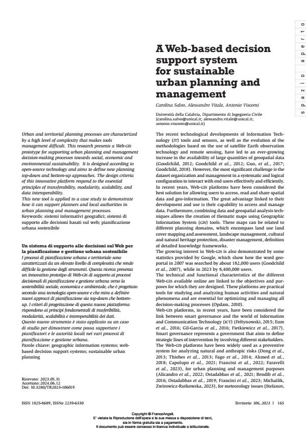
Article preview

FrancoAngeli is member of Publishers International Linking Association, Inc (PILA), a not-for-profit association which run the CrossRef service enabling links to and from online scholarly content.

Urban and territorial planning processes are characterized by a high level of complexity that makes tools management dif?cult. This research presents a Web-GIS prototype for supporting urban planning and management decision-making processes towards social, economic and environmental sustainability. It is designed according to open-source technology and aims to de?ne new planning top-down and bottom-up approaches. The design criteria of this innovative platform respond to the essential principles of transferability, modularity, scalability, and data interoperability. This new tool is applied to a case study to demonstrate how it can support planners and local authorities in urban planning and management processes.

I processi di pianificazione urbana e territoriale sono caratterizzati da un elevato livello di complessità che rende difficile la gestione degli strumenti. Questa ricerca presenta un innovativo prototipo di Web-GIS di supporto ai processi decisionali di pianificazione e gestione urbana verso la sostenibilità sociale, economica e ambientale, che è progettato secondo una tecnologia open-source e che mira a definire nuovi approcci di pianificazione sia top-down che bottomup. I criteri di progettazione di questa nuova piattaforma rispondono ai principi fondamentali di trasferibilità, modularità, scalabilità e interoperabilità dei dati. Questo nuovo strumento è stato applicato su un caso di studio per dimostrare come possa supportare i pianificatori e le autorità locali nei vari processi di pianificazione e gestione urbana.

Keywords: geographic information systems; webbased decision support systems; sustainable urban planning

  1. Francini M., Salvo C., Vitale A., 2023, «Combining Deep Learning and Multi-Source gis Methods to Analyze Urban and Greening Changes». Sensors, 23, 8: 3805.
  2. Geoportale Regione Basilicata, https://rsdi.regione.basilicata.it/ppr/ (accessed: 2023.04.08).
  3. Ahmed B., Rahman M.S., Islam R., Sammonds P., Zhou C., Uddin K., Al-Hussaini T.M., 2018, «Developing a Dynamic Web-gis Based Landslide Early Warning System for the Chittagong Metropolitan Area, Bangladesh». ISPRS International Journal of Geo-Information, 7, 12: 485.
  4. Geoportale Regione Calabria, http://geoportale.regione.calabria.it/ (accessed: 2023.04.08).
  5. Geoportale Regione Emilia-Romagna, https://geoportale.regione.emilia-romagna.it/ (accessed: 2023.04.08).
  6. Alicandro M., Zollini S., Oxoli D., Pascucci N., Dominici D., Brescia, D., 2022, «Design and implementation of an open-source web-gis to manage the public works of Abruzzo region: an example towards the digitalization of the management process of public administrations». International Archives of the Photogrammetry, Remote Sensing and Spatial Information Sciences ISPRS Archives, XLVIII-4/W1: 21-26.
  7. Arias Munoz C., Brovelli M.A., Kilsedar C.E., Moreno-Sanchez R., Oxoli D., 2017, «Web mapping architectures based on open specifications and free and open source softwarein the water domain». isprs Annals of the Photogrammetry, Remote Sensing and Spatial InformationSciences, 4, 2W4, 23: 30.
  8. Bendib A., Hadda D., Mahdi K., 2016, «Application of Webgis in the development of interactive interface for urban management in Batna City». Journal of Engineering and Technology Research Full Length Research Paper, 8, 2: 13-20. DOI: 10.5897/JETR2015.0579
  9. Bernard L., Kanellopoulos I., Annoni A., Smits P., 2005, «The European geoportal one step towards the establishment of a European Spatial Data Infrastructure». Computers, Environment and Urban Systems, 29, 1: 15-31.
  10. Büttner G., Kosztra B., 2011, Manual of CORINE Land Cover changes. Copenhagen: European Environment Agency.
  11. Capolupo A., Monterisi C., Saponieri A., Addona F., Damiani L., Archetti R., Tarantino E., 2021, «An Interactive Webgis Framework
  12. Coastal Erosion Risk Management». Journal of Marine Science and Engineering, 9, 6: 567.
  13. Coetzee S., Ivanova I., Mitasova H., Brovelli M.A., 2020, «Open geospatial software and data: A review of the current state and a perspective into the future». isprs International Journal of Geo-Information, 9, 2: 90.
  14. Database di Sintesi Nazionale. www.igmi.org/it/dbsn-database-di-sin- tesi-nazionale (accessed: 2023.04.08).
  15. Dong S., Wang X., Yin H., Xu S., Xu R., 2013, «Semantic enhanced Webgis approach to visualize Chinese historical natural hazards». Journal of Cultural Heritage, 14, 3: 181-189.
  16. EEA Briefing, 2012, GMES land monitoring service. www.eea.europa.eu/ themes/landuse/.
  17. Eom S.J., Choi N., Sung W., 2016, «The use of smart work in government: Empirical analysis of Korean experiences». Government Information Quarterly, 33, 3: 562-571.
  18. European Commission, 2020, Communication to the commission open source software strategy 2020 2023 Think Open. C(2020) 7149 final, Brussels: European Commission.
  19. Fago P., Pignatelli C., Piscitelli A., Milella M., Venerito M., Sansò P., Mastronuzzi G., 2014, «Webgis for Italian tsunami: A useful tool for coastal planners». Marine Geology, 355: 369-376.
  20. Faravelli M., Bozzoni F., Zuccolo E., Di Meo A., Quaroni D., Polli D., Rodriguez-Plata R., Martelli L., Borzi B., Lai C.G., 2023, «A Webgis platform for managing the seismic risk at regional scale: the case study of the Emilia-Romagna Region». Proceedings of the xix anidis Conference, Seismic Engineering in Italy, Turin, 11-15 september 2022. Procedia Structural Integrity, 43-50.
  21. Fietkiewicz K.J., Mainka A., Stock W.G., 2017, «eGovernment in cities of the knowledge society. An empirical investigation of Smart Cities’ governmental websites». Government Information Quarterly, 34, 1: 75-83.
  22. Francini M., Salvo C., Viscomi A., Vitale A., 2022, «A Deep Learning-Based Method for the Semi-Automatic Identification of Built-Up Areas within Risk Zones Using Aerial Imagery and Multi-Source gis Data: An Application for Landslide Risk». Remote Sensing, 14, 17: 4279.
  23. Geoportale Regione Lazio, https://geoportale.regione.lazio.it/ (accessed: 2023.04.08).
  24. Geoportale Regione Lombardia, www.geoportale.regione.lombardia.it/ (accessed: 2023.04.08).
  25. Geoportale Regione Puglia, https://pugliacon.regione.puglia.it/freegis/ RR242005/ (accessed: 2023.04.08).
  26. Geoportale Regione Sicilia, www.sitr.regione.sicilia.it/geoportale (accessed: 2023.04.08).
  27. Geoportale Regione Toscana, https://www.regione.toscana.it/-/geo- scopio (accessed: 2023.04.08).
  28. Geoportale Regione Umbria, http://www.umbriageo.regione.umbria.it/ pagine/geoportale-000 (accessed: 2023.04.08).
  29. Geoportale Regione Veneto, https://idt2.regione.veneto.it/ (accessed: 2023.04.08).
  30. Gil-Garcia J.R., Zhang J., Puron-Cid G., 2016, «Conceptualizing smartness in government: An integrative and multi-dimensional view». Government Information Quarterly, 33, 3: 524-534.
  31. Goodchild M.F., 2012, «The future of digital earth». Annals of gis, 18, 2: 93-98. DOI: 10.1080/19475683.2012.668561
  32. Goodchild M.F., 2018, «Reimagining the history of gis». Annals of gis, 24, 1: 1-8. DOI: 10.1080/19475683.2018.1424737
  33. Goodchild M.F., Fu P., Rich P.M., 2007, «Sharing Geographic Information: An Assessment of the Geospatial One-Stop». Annals of the Association of American Geographers, 972: 250-266.
  34. Goodchild M.F., Guo H., Annoni A., Bian L., de Bie K., Campbell F., Craglia M., Ehlers M., van Genderen J., Jackson D., Lewis A.J., Pesaresi M., Remetey-Fülöpp G., Simpson R., Skidmore A., Wang C., Woodgate P., 2012, « Next-generation Digital Earth». Proceedings of the National Academy of Sciences, 109, 28: 11088-11094.
  35. Guo H., Liu Z., Jiang H., Wang C., Liu J., Liang D., 2017, «Big Earth Data: A new challenge and opportunity for Digital Earth’s development». International Journal of Digital Earth, 10, 1: 1-12. DOI: 10.1080/17538947.2016.1264490
  36. Kulawiak M., Kulawiak N., Sulima M., Sikorska K., 2022, «A novel architecture of Web-gis for mapping and analysis of echinococcosis in Poland». Applied Geomatics, 14, 2: 181-198.
  37. ISTAT, 2011, 15° Censimento della Popolazione e delle Abitazioni. www. istat.it/it/censimenti-permanenti/censimenti-precedenti/popolazi one-e-abitazioni/popolazione-2011 (accessed: 2023.11.21).
  38. Michalik A., Zwirowicz-Rutkowska A., 2023, «A Geoportal Supporting Spatial Planning in Poland: Concept and Pilot Version». Geomatics and Environmental Engineering, 17, 2: 5-30.
  39. Mobasheri A., Mitasova H., Neteler M., Singleton A., Ledoux H., Brovell, M.A., 2020, «Highlighting recent trends in open source geospatial science and software». Transactions in gis, 24:1141-1146.
  40. Mushonga H.T., Banda F., Mulolwa A., 2017, «Development of a web based gis for health facilities mapping, monitoring and reporting: A case study of the Zambian Ministry of health». South African Journal of Geomatics, 6, 3: 321.
  41. Opdam P., 2010, «Learning science from practice». Landscape Ecology, 25: 821-823.
  42. Open Geospatial Consortium, 2023. GeoPackage Encoding Standard.
  43. Ostadabbas H., Merz H., Weippert H., 2021, «Integration of urban spatial data management and visualization with enterprise applications using open-source software». International Archives of the Photogrammetry, Remote Sensing and Spatial Information Sciences
  44. isprs Archives, 43, number B4-2021: 307-312.
  45. Ostadabbas H., Weippert H., Beh F.J., 2019, «Database transformation, cadastre automatic data processing in qgis and implementation in web gis». International Archives of the Photogrammetry, Remote Sensing and Spatial Information Sciences isprs Archives, 42, number 4/W14: 175-178.
  46. Oxoli D., Cannata M., Terza V., Brovelli M.A., 2019, «Natural heritage management and promotion through free and open source software: a preliminary system design for the Insubriparks project». International Archives of the Photogrammetry, Remote Sensing and Spatial Information Sciences isprs Archives, 42, number 4/W14: 179-183.
  47. QGIS Development Team, 2023, QGIS Geographic Information System. Open Source Geospatial Foundation.
  48. Randazzo G., Italiano F., Micallef A., Tomasello A., Cassetti F.P., Zammit A., D’amico S., Saliba O., Cascio M., Cavallaro F., Crupi A., Fontana M., Gregorio F., Lanza S., Colica E., Muzirafuti A., 2021, «Webgis implementation for dynamic mapping and visualization of coastal geospatial data: A case study of bess project». Applied Sciences, 11, 17: 8233.
  49. Stefanov S., 2021, «Visualization of Meteorological Data Sets With Open Source gis». International Journal of Computer Trends and Technology, 69, 4: 15-17. DOI: 10.14445/22312803/IJCTT-V69I4P104
  50. Thiebes B., Bell R., Glade T., Jäger S., Anderson M., Holcombe L., 2013, «A Webgis decision-support system for slope stability based on limit-equilibrium modelling». Engineering Geology, 158: 109-118.
  51. Vacca G., Fiorino D.R., Pili D., 2017, «A webgis for the knowledge and conservation of the historical buildings in Sardinia (Italy)». The International Archives of the Photogrammetry, Remote Sensing and Spatial Information Sciences, XLII-4/W2: 171-178.

Carolina Salvo, Alessandro Vitale, A Web-based decision support system for sustainable urban planning and management in "TERRITORIO" 106/2023, pp 165-176, DOI: 10.3280/TR2023-106019