Predicting of educational buildings locations by integrating spatial distribution assessment techniques high schools in Mosul as a case study1

Titolo Rivista ARCHIVIO DI STUDI URBANI E REGIONALI
Autori/Curatori Emad Hani Ismaeel, Rawia Marwan Dabdoob, Khalid Ahmed Hussein
Anno di pubblicazione 2023 Fascicolo 2022/135 Lingua Inglese
Numero pagine 25 P. 135-159 Dimensione file 833 KB
DOI 10.3280/ASUR2022-135007
Il DOI è il codice a barre della proprietà intellettuale: per saperne di più clicca qui

Qui sotto puoi vedere in anteprima la prima pagina di questo articolo.

Se questo articolo ti interessa, lo puoi acquistare (e scaricare in formato pdf) seguendo le facili indicazioni per acquistare il download credit. Acquista Download Credits per scaricare questo Articolo in formato PDF
Anteprima articolo

FrancoAngeli è membro della Publishers International Linking Association, Inc (PILA)associazione indipendente e non profit per facilitare (attraverso i servizi tecnologici implementati da CrossRef.org) l’accesso degli studiosi ai contenuti digitali nelle pubblicazioni professionali e scientifiche

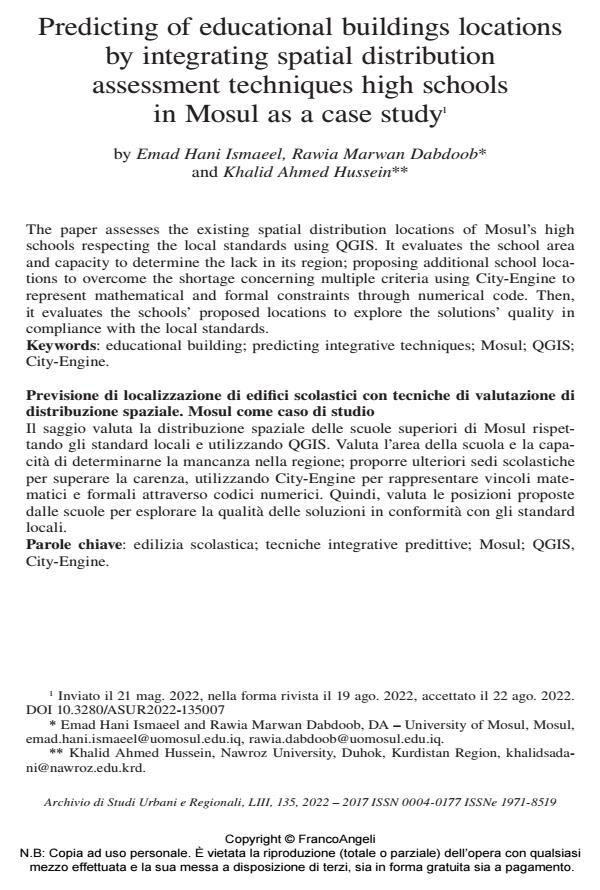
The paper assesses the existing spatial distribution locations of Mosul’s high schools respecting the local standards using QGIS. It evaluates the school area and capacity to determine the lack in its region; proposing additional school loca- tions to overcome the shortage concerning multiple criteria using City-Engine to represent mathematical and formal constraints through numerical code. Then, it evaluates the schools’ proposed locations to explore the solutions’ quality in compliance with the local standards.

Il saggio valuta la distribuzione spaziale delle scuole superiori di Mosul rispet- tando gli standard locali e utilizzando QGIS. Valuta l’area della scuola e la capa- cità di determinarne la mancanza nella regione; proporre ulteriori sedi scolastiche per superare la carenza, utilizzando City-Engine per rappresentare vincoli mate- matici e formali attraverso codici numerici. Quindi, valuta le posizioni proposte dalle scuole per esplorare la qualità delle soluzioni in conformità con gli standard locali.

Keywords:edilizia scolastica; tecniche integrative predittive; Mosul; QGIS, City-Engine.

  1. Abraha T.A. (2019). Analyzing spatial and non-spatial factors that influence educational quality of primary schools in emerging regions of Ethiopia: Evidence from geospatial analysis and administrative time series data. Journal of Geography and Regional Planning, 12(1): 10-19. DOI: 10.5897/JGRP2018.070
  2. Agrawal S. and Gupta R. (2016). School Mapping and Geospatial Analysis of The Schools in Jasra Development Block of India. The International Archives of the Photogrammetry. Remote Sensing and Spatial Information Sciences, XLI-B2, 2016 XXIII ISPRS Congress, Prague, 12-19 July.
  3. Al-Enazi M., Mesbah S. and Anwar A. (2016). Schools Distribution Planning using GIS in Jeddah City. International Journal of Computer Applications, 138(1): 33-36.
  4. Alfred D.M., Muskut G.B. and Jerry S.H. (2015). Development of geospatial database for the management of secondary schools facilities using GIS in Mubi North L.G.A of Adamawa State, Nigeria. Sky Journal of Educational Research, 3(5): 51-60.
  5. Al-hanbali N., Al-kharouf R. and Alzoubi M.B.(2005). Integration of Geo Imagery and Vector Data Into School Mapping GIS Data-Model For Educational Decision Support System In Jordan. Design and Operation of Spatial Decision Support Systems. In: ISPRS, Commission II, WG II/5. -- Available at: www.researchgate.net/publication/230557409
  6. Al-Masuudi N.K. and Muhammad A. (2015). A Spatial Planning of Public Schools Distribution in Sohar Using GIS. Proceedings of the Conference: New Trends in Multidisciplinary Research and Practice, Istanbul, Turkey.
  7. Alnime S. and Radhwan R. (2019). Spatial and spatial analysis of the distribution of schools in the center of Nineveh province Mosul. Journal of Nursing, 7(2): 72-90.
  8. Alrawi N., Shabana B., El-bakry H.M. and Saleh A.A. (2015). A proposed Decision Support System for Managing Educational Human Resources Based on GIS. International Journal of Advanced Research in Computer Science and Technology (IJARCST 2015), 3(4).
  9. Al-Rasheed K. and El-Gamily H.I. (2013). GIS as an Efficient Tool to Manage Educational Services and Infrastructure in Kuwait. Journal of Geographic Information System, 5: 75-86.
  10. Alsabaawi Y.H. and Ayoub H.H. (2019). The Growing Phenomenon of Slum Areas And Their, Impact On The Development Sectors Before The Events of 10/6/2014, Analytical Study in Mosul city. Opción. Revista de Ciencias Humanas y Sociales, Publicaciones Científicas de la Facultad Experimental de Ciencias, Universidad del Zulia, Maracaibo, 35(21): 2899-2921.
  11. Al-Zeer N.M. (2005). Analysis of The Spatial Distribution of Public Secondary Girls and Boys Schools In Riyadh, Saudi Arabia. Thesis. University of Leicester. ProQuest LLC 2014, United States.
  12. Aschale T. (2017). Assessment of Schools Spatial Distribution and Identifying Suitable Areas by Using GIS Technology: In Case of Debre Markos Town North Western Ethiopia. Journal of Resources Development and Management, 35.
  13. Black M., Ebener S., Aguilar P.N., Vidaurre M. and El Morjani Z. (2004). Using GIS to measure physical accessibility to health care. Proceedings of the ESRI 2004 International Health GIS Conference. Redlands, CA: ESRI.
  14. Cheng G., Du Q. and Ma H. (2008). The Design and Implementation of Rules Based Knowledge Base for Transportation. IEEE International Conference on Computer Science and Software Engineering, 3: 1035-1038. DOI: 10.1109/CSSE.2008.140
  15. El-Gamily H.I. and Al-Rasheed K. (2015). Deploying an Interactive GIS System for Facility and Asset Management: Case Study-Ministry of Education, Kuwait. Journal of Geographic Information System, 7: 191-201.
  16. Eray O. (2012). Application of Geographic Information System (GIS) in Education.Journal of Technical Science and Technologies, 1(2): 53-58.
  17. Lagrab W. and Aknin N. (2017). A Suitability Analysis of Elementary Schools- Based Geographic Information System GIS, A Case Study of Mukalla Districts in Yemen. Journal of Theoretical and Applied Information Technology, 28th Feb., 95(4). Available at: www.researchgate.net/publication/316137026
  18. Ledesma G., Nikolic J. and Pons V.O. (2019). Towards a More Energy Efficient Educational Architecture in Cities: Typologies of Barcelona and Quito Public Schools for Energy Modelling. En XIII CTV 2019 Proceedings: XIII International Conference on Virtual City and Territory: “Challenges and paradigms of the contemporary city”, UPC, Barcelona, October 2-4, p. 8505.
  19. Makadi Y.C., Sati A.S. and Dankaka I.(2019). Geospatial Distribution of Public Secondary in Gombe Local Government Area, Gombe State of Nigeria. International Journal on Research in STEM Education, 1(1): 30-39.
  20. Makino Y. and Watanabe S. (2002). The Application of GIS to School Mapping in Bangkok. Asian Center for Research on Remote Sensing (ACRORS). Retrieved from www.a-ar-s.org/acrs/proceeding/ACRS2002/Papers (last access: September 27 2011).
  21. Mawuko G.K. (2018). Applicationof Geographic Information System To School Mapping At Madina In The La-Nkwantanang Municipality. Bachelor of Science Thesis. Department of Planning, Kwame, Nkrumah University of Science and Technology, Kumasi.
  22. Moghayer T.J., Abdelhamid A. and Xingping W. (2018). Spatial Analysis of Public Services (schools) in Nablus City Using the Tool of Geographic Information System (GIS). International Journal on: The Academic Research Community Publication, IEREK Press Journals. -- Available at: www.ierek.com/press
  23. Murad A. (2019). Using GIS for Determining Variations in Health Access in Jeddah City, Saudi Arabia. International Journal of Geo-Information, ISPRS Int. J. Geo-Inf. 2018, 7: 254.
  24. Musa R., Hammad A., Khawaldah H. and Alzboun N. (2015). Geographical Distribution of Public Secondary Schools and Factors Affecting Success Rates in Rammallah and Al-Bireh Governorate using GIS. European Journal of Social Sciences, 50(1): 77-95. -- Available at: www.researchgate.net/ publication/292329285
  25. Ngigi M.M., Musiega D. and Mulefu F. (2012). Planning and Analysis of Educational Facilities using GIS: A Case Study of Busia County, Kenya. Conference: AGSE 2012, UniversitiTeknologi Malaysia (UTM), Johor Bahru, Malaysia. -- Available at: www.researchgate.net/publication/275209527
  26. Ogunyemi S., Muibi K., Alaga A., Babatimehin O., Ajileye O., Samson S., Adewoyin J., Oloko-Oba M., Fasote O., Olaoluwa I. and Halilu A. (2016). A Geospatial Approach to Socio Economic Factors Influencing Accessibility to Secondary Educational Institution in Ogun State, Nigeria. British Journal of Education, Society and Behavioral Science, Science domain International, 13(4): 1-11. DOI: 10.9734/BJESBS/2016/2218
  27. Ogunyemi S., Muibi K., Ezekiel E., Fabiyi O. and Ahmad H. (2014). A geospatial approach to evaluation of accessibility to secondary educational institution in Ogun State, Nigeria. 7th IGRSM International Remote Sensing and GIS Conference and Exhibition IOP Publishing. IOP Conf. Series: Earth and Environmental Science 20 012045. DOI: 10.1088/1755-1315/20/1/01204
  28. Oloko-oba M., Rakiat H., Henry O., Success O., Ali A. and Idayat O. (2016a). A GIS Approach to Evaluation of Accessibility to Private Primary Schools
  29. in Ilorin West Local Government Area, Kwara State, Nigeria. International Journal of Scientific Research in Science, Engineering and Technology, 2(1).
  30. Oloko-oba M., Akintunde O., Alaga A., Badru R., Ogbole J., Popoola O. and Samson S. (2016b). Spatial Distribution of Primary Schools in Ilorin West Local Government Area, Kwara State, Nigeria. Journal of Scientific Research and Reports, Sciencedomain international JSRR, 9(6), 1-10. DOI: 10.9734/JSRR/2016/2212
  31. Sarhan B.A. (2002). Planning Standards in School Development, Case Study for Ramallah and Al-Bireh Governorate (Master’s Thesis). An-Najah National University, College of Graduate Studies, Palestine.
  32. Sule J., Abdullahi H. and Bungwon J. (2012). Acquisition of Geospatial Database for Primary Schools in Kaduna Metropolis. Research Journal of Environmental and Earth Sciences, Maxwell Scientific Organization, 4(3): 244-247.
  33. Sumari N., Tanveer H., Shao Z. and Kira E. (2019). Geospatial Distribution and Accessibility of Primary and Secondary Schools: A case of Abbottabad City, Pakistan. Proceedings of the International Cartographic Association, 29th International Cartographic Conference (ICC 2019), Tokyo, Japan, 15-20 July.
  34. Supuwiningsih N.N. (2019). Distribution Trenof Senior High School As Origin School of College Student Stikom Bali Base GIS. Journal of Engineering Technologies and Management Research, Supuwiningsih, 6(12).
  35. The Public Authority for Housing (2010). The Basic Criteria for Urban Housing. The Ministry of Construction and Housing, The Public Authority for Housing, Studies Division.
  36. Thomas F. (2021). An Assessment On The Implementation ofGISAnd Remote Sensing In Teaching Geography In Zimbabwean Secondary SCHOOLS. i-manager’s Journal on School Educational Technology, 16(4).
  37. Umar H.A., Isma’il M., Jaro I.M., Wankata W. and Maiwada A. (2016). Spatial Analysis of Distribution of Secondary Schools in Giwa Zone of Kaduna State, Nigeria. International Journal of Science For Global Sustainability, Federal University, Gusau-Nigeria, IJSGS, 2(4). Available at: www.researchgate.net/ publication/324438238
  38. UN Habitat (2016). City Profile of Mosul, Iraq, Multi-sector assessment of a city under siege October 2016. New York: United Nations Human Settlements Programme (UN-Habitat).
  39. Wali U. and Musa I. (2015). GIS as a Tool for Education Decision Support System: A Demonstration with Public Primary Schools in Zaria City Kaduna State Nigeria. European Researcher, Academic Publishing House Researcher, 96(7): 511-522.
  40. Wazzan K. (2017). The Spatial Distribution of the Basic Education Schools in Lattakia City (Syria). Journal of Educational and Social Research, MCSER Publishing, Rome-Italy, 7(1).

Emad Hani Ismaeel, Rawia Marwan Dabdoob, Khalid Ahmed Hussein, Predicting of educational buildings locations by integrating spatial distribution assessment techniques high schools in Mosul as a case study1 in "ARCHIVIO DI STUDI URBANI E REGIONALI" 135/2022, pp 135-159, DOI: 10.3280/ASUR2022-135007